


|
|


United States:

|
Northern Forest Canoe Trail Nonprofit organization.
700-mile water trail from Old Forge, New York to Fort Kent, Maine.
NFCT maps and guidebook show you how to navigate the rivers lakes and streams of the NFCT.
|
Paddling.com's On-line Paddling Locations Map
Browse over 35,000 canoeing launch sites, take outs, and destinations to research and plan the perfect place to paddle near you!
Also download an app for your phone.
|
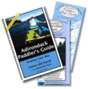
Paddlesports Press - Adirondack Paddlers Guide and Maps.
- The 264 page spiral bound Adirondack Paddlers Guidebook is a companion to the Paddler�s Maps below.
- Adirondack Paddler's Map - North, now in it�s 10th edition has become the quintessential Adirondack Paddling Map.
- Adirondack Paddler's Map - South, Same great detail as the Adk Paddler�s Map � North.
- Additional map areas available.
|
Chrismar Mapping Services Inc. - Canada's Adventure Map® series of original topographic recreation maps featuring National Parks, Provincial Parks and other popular Canadian destinations specifically designed for outdoor adventurers such as paddlers, hikers and backpackers.
Paddle Planner.com On-line Interactive Canoe Route Mapping and Planning for Boundary Waters Canoe Area, the Everglades, Algonquin Provincial Park, and others.
|
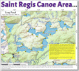
Andy Arthur's Saint Regis Canoe Area Maps
Andy Arthur's Blog with downloadable maps for paddling the Saint Regis Canoe Area in the Adirondacks.
|
W.A. Fisher Maps and Guides Boundary Waters Canoe Area maps and guides.
Susco Waterproof maps and guidebooks.
Paddling maps for Pennsylvania, Ohio, New York, New Jersey, West Virginia, Kentucky, Maryland, Virginia, Michigan, Illinois, and Indiana.
True North Map Co BWCA & Quetico maps crafted for navigation and display.
Berkeley County Blueways Over 235 miles of navigable South Carolina water.
Washington Water Trails Association protecting and promoting public access to Washington State waterways, shorelines, and marine trails for human-powered watercraft.

Canada:
Canadian Canoe Routes
Canoe Maps Canada
My Canoe Country - The Paddle Planner
Ontario Canoe Map Guides
On Line by State:
Florida
Florida Paddling Trails Association
Maine
Michigan
Rhode Island
South Carolina
Texas
Mapping Utilities and Apps:
Magnetic-Declination.com Find the magnetic declination
at your location
Compass Basics by Tom Watson
Compass Basics - The Marine Compass
EasyGPS Upload and download waypoints, routes, and track your paddles with your Garmin, Magellan, or Lowrance GPS.
Gaia GPS Maps and tracking for web and phones
Outside North America:
The Bliss Canoe Trail Britian
862 mile circumnavigation of British inland waterways.
If you publish maps and guidebooks for canoeing and are not listed yet and would like to be added, contact me.
|
|